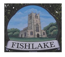
The Township Boundary of Fishlake: The physical evidence.
Background.
Townships can be regarded as areas of civil organisations unlike parishes which are ecclesiastical areas. Very often the areas they cover are identical, sometimes they are not. In the case of Fishlake and Sykehouse they were separate townships or civil areas but the ecclesiastical parish was the same until 1860 when Sykehouse achieved independent statues. In this case the dividing boundary was and still is the Clay Dike.
Township and parish boundaries may sometimes be of great antiquity. In some parts of England it has been suggested that some pre-date the Roman period, enclosing estates that were going concerns as early as the Bronze Age. This theory is based on the relationship of the boundary to features such as burial mounds, old trackways, Roman roads, field systems etc., which can sometimes be shown to be of later date. The boundary itself takes many forms, for example double hedges, linear earthworks, water courses, boundary stones and other natural or artificial features.
Many physical remains, both the boundaries and the structures in their vicinity are now being destroyed. This is serious, since they provide essential evidence for both local historians and archaeologists. Consequently in 1977 Leeds university, Extra-mural Department lead by Project Director Mrs HE Jean Le Patourel began the Yorkshire Boundary Project. This was founded to record township boundaries.
In 1979 I (the author) was approached to record the boundaries of both Fishlake and Sykehouse. Having perambulated these boundaries several times over previous years it made sense to get involved with this project. So it was that during April and May 1980 I undertook to record these boundaries. The result are recorded below.
Perambulation Day Sunday April 25. Thanks to Google Images.
The survey brief was to record the boundary line as shown on the first edition OS map of c 1850's.
Notes for the reader.
The account begins with the numbers on the survey map (not included). Then the nature of the boundary. Followed by a description of the boundary or nearby features and field names etc. Then the OS grid reference.
-
Old river bed (dry, reedy) undefined. Remains of river Don channel. River now diverted South of here. The new cut, rebanking and flood plane all late 1940's. Boundary still follows the old course. North of village and "landing Place" or Quay, this is remains of medieval inland port. Also ancient ferry crossing point. 65491309.
-
As above. Staith marked here on 1752 survey map. 65391311.
-
Two banks and flood plane, grassy. Boundary still undefined. Stop-up bank and floodplain bank both 10 feet high both late 1940s. Here also Taining drain, medieval open drain, now empties into modern drain. Also a barrier bank runs north 6 feet high to stop flooding from the west 17th century 652 61293.
-
Another bank and grassy plain. Bank 7 feet high stretching from 3 to 5 is filled in old river channel. Boundary undefined but following centre of old river as 1854 first edition OS map. All landscaping bank drains flood arches late 1940s. 65251288.
-
Centre of present river. Boundary runs west in centre of existing old river 6520 1276.
-
South bank of the river. Deviation since 1854 but it run centre to river. 6453 1243.
-
South bank of the river. Further deviation as above. Due to man-made alterations 20th century. 6416 1217.
-
Floodplain. Embanking along to Stainforth 20th century.
-
Centre of river. Boundary goes under Stainforth Bridge, stone 1740s formerly a stone Ford and ferry point. The north along west side of bridge. Here the boundary joins the township and parish boundary of Kirk Bramwith. Also the Osgodcross wapentake on the west. The lowest Strafford wapentake on East and South. Face of wall of bridge ashlar blocks of magnesium limestone. Along the west side of Stone bridge. 6408 1212.
-
Stone wall same as bridge. Follows for several yards a wall extending from bridge. 6407 1214.
-
Wire fence. This is modern and incorporating a field gate. 6407 1215.
-
Hawthorn hedge. Follows the field edge. All fields in township here are in West Nab an area of common until the enclosure of 1812 to 1825 when all fields were laid out. 6407 1217.
-
Metaled road. Boundary crosses Plumtree Hill Road. 6416 1281.
-
Hawthorne hedge remnant. South of Boundary Taining Drain this diverted course is of enclosure date 1812 to 1825. 64181283.
-
Pond. Could be old clay hole for brick making late 19th century. 643129.
-
Grassy roadside verge. Alongside the verge his Green Dyke mediaeval feature first referred to in 1539 when it was the west Boundary of Hatfield Chase. It is the major feature on west the boundary of this township. It is a principal drain. 6419 1284.
-
Grassy roadside verge. Further east from Boundary and Green Dyke is a barrier bank about 10 feet high. This bank is early 19th century to stop flooding from west. 6415 1290.
-
Centre of Green Dyke, water. At this point Boundary runs in the centre of Dyke this Dyke meanders considerably showing that although medieval it was cut a long and early existing Boundary. 6356 1338.
-
Centre of Green Dyke, water. Barrier bank almost at field level. Ground rising. 6344 1360.
-
Metalled road. Green Dyke carried on the Westfield Road an east west route linking Kirk Bramwith with parish with Fishlake. 6633 1374. Artefact a late neolithic early Bronze Age flint end scraper. Other pieces of work flint in the vicinity. 633139.
-
Centre of Green Dike, water. Adjoining Boundary of path originally an access road to Westfield house now truncated. Also a barrier bank runs parallel with it. 6319 1407.
-
Canal, water. Here the Boundary cross is the New Junction canal open 1905. Much disturbance here from this date ie Bridge house embankment and flood gates ditchers etc. 6300 1434.
-
Centre of Green Dyke, water. Boundary continues in Green Dyke. Also barrier bank at the height of 3 feet continues 62961441. From here onwards the bank is quite heavily covered by hawthorns. Some 100 yards from Boundary is a farmstead called Westfield House 18th-century buildings stand on an earlier site. 6292 1448.
-
Clay Dike north side. Green Dike joins Clay Dike at Hell Wickett through a stone bridge and sluice. Clay Dike appears to be an ancient township Boundary between Fishlake and Sykehouse. After 1860 also parish boundary. Clay Dike is chiefly a major artificial drainage dike cut before 1208 when it was first mentioned. Hell Wickett, the gates of hell, may refer to an early crossing point along Clay Dike first mention 1539. Boundary continues along north side of Clay Dike in east direction. 6191522.
-
As above. Here an old thick wood of mixed variety as on 1854 map. 6213 1523.
-
As above. Above feature reduced to a single line of trees and bushes also includes footpath. This stretch known as Smallhedges Reins. Smallhedges, and narrow ditch with a hatch or grating across it. The above trees and bushes are situated on the low 2 feet high linear bank and extends to 27. 6236 1528.
-
As above. Here a bridge and lane Smallhedges Lane joins boundary at this point it runs south from 27. Also at this point a linear feature, bank and side ditch with trees and bushes turns 90 degrees and runs South for 100 yds at a height of 3-4 ft with a lane adjoining. 63101570.
-
Boundary undefined. The New Junction canal crosses a Boundary at Clay Dike is channeled underneath 1905. 6371 1589.
-
Clay Dike Northside. Bridge takes metaled road over Clay Dike at Bell Green. 63892693.
-
As above. At this point an additional dike runs parallel with Clay Dike for about half a mile. A supporting drain of mid-17th century date hence name Double Dyke now substantially dried up. 6436 1598.
-
South side of Clay Dike, water. Boundary run south side of Clay Dike adjacent to Boundary is linear earth work partly a raised headland partly made up of spoil from dike some feet high. This large field to South shows extensive remains of ridge and furrow complete with headlands north and south. 6514 1583.
-
Undefined in grass field with a return along Hawthorne hedge. Boundary forms is a strange peg shape seemingly taking in one selion (a medieval term for an open strip of land or small field). Follows an undefined course south to Carr Head Lane 4 feet from track of old fence and north 4 feet from roots of Hawthorn hedge adjacent to Strunns Lane back to Clay Dike. The area is on 1825 enclosure map recorded as 1 acre, one rood and eight to perches. 6539 1585.
-
Southside of clay dike, water. A bridge takes Strunns Lane across Clay Dike Boundary continues in centre of dike 6540 1585.
-
Clay Dike north side. Boundary now on north side of Dike as it makes a right angle turn. Note the central part of township most prone to drainage problems. 6580 1585.
-
Centre of Clay Dike, water. Clay Dike carried on the Black Syke Lane. Boundary now in centre of Dike. 6632 1572.
-
North side of Clay Dike. Clay Dike carried under low Ings Lane Boundary on north side of dike. Note, this stretch of Clay Dike otherwise known as Black Shaw Dike. 6664 1574.
-
Centre of River Don, water. Here Clay Dike empties via a clough or sluice Blackshaw clough into River Don. Boundary follow centre of river. North Branch of River Don is an artificial cut either Norman or more likely Roman in date see Yorkshire Archaeological Journal vol. 47, p 15-22. There is a substantial river bank adjoining the Don averaging some 12 ft high along its length. 67241572.
-
As above. Here an important crossing point into Fishlake. From medieval times a ferry point and from 1887 a bridge, called Jubilee Bridge. A Staith shown here on 1752 survey and a watering place marked here on enclosure map 1825. 67404180.
-
River bank. Boundary shifts to bank of Don for a short distance. Then returns to centre of river. 6747 1463.
-
Old Don course, water. Boundary follows old course of River Don replaced by new cut about 1947. Boundary crosses a modern bank and follow centre of old river still partly water filled. 674 2144.
-
As above. Here a Staith marked on 1752 survey map. 674143.
-
River bank. Boundary continues following old River course pre 1947 from point 42 to point 45. It takes an undefined course over a bank 15 feet high. Across the flood plain to South bank,at present River Don 15 feet high. 6696 1345.
-
Centre of River Don, water. Boundary centre of River Don for short distance. 6676 1344.
-
River Bank, then return to centre of river, water. Boundary turns to South bank of river before returning to centre of the river. The stone above this point is a modern water authority marker. 6655 1328.
-
River bank. Boundary turn south and leaves old course of river Don which originally run in the north west direction into village. The undefined boundary now crosses marshy ground and roughly follows on embankment 15 feet high for about half a mile to 46. On 1854 map this Boundary follows a small water course where the bank now is. 6636 1321.
-
Grassy banks and flats undefined. It takes a right angle turn running north crossing present river and bank. It continues across the flood plain over another bank some 15 feet high to point 1 and the start of this survey. 6559 1286.