AN INVENTORY OF FISHLAKE ROADS AND LANE PAST AND PRESENT.
Fishlake History Society
Recording historical information before it disappears
- Historical Research
- Crime in Fishlake
- Fishlake Hall
- Whats in a name
- Rev J Leeson
- Fishlake's Physical History
- An Old Sketch Map of Fishlake
- The Township of Fishlake
- Published Histories of Fishlake
- Rev Eliezer Flecker
- Canon G Ornsby
- The Fishlake Pinder
- Fishlake Constable Accounts
- Stone relics to be found in Fishlake Vicarage Garden
- A Catalogue of Fishlake Historical records formally kept at Fishlake Church
- Fishlake Hearth Tax 1672
- Who tried to settle in Fishlake many years ago.
- What the travel writer found in Fishlake 120 years ago.
- Archdeacon Hopkins Badnall, Vicar of Fishlake 1886-1888. A two year ministration.
- Fishlake Endowed School Play.
- L'Isle Family and The Fishlake Connection.
- A Short History of Flooding in Fishlake.
- The First Photographers who captured pictorial images of Fishlake
- Early History of Fishlake Ferry
- Primitive Methodism in Fishlake and Two Preachers
- The Township Boundary of Fishlake
- The Phenomena of Detached Enclaves of Townships. The case of Fishlake and Sykehouse
- A catalogue of Incumbents at St Cuthbert’s, Fishlake
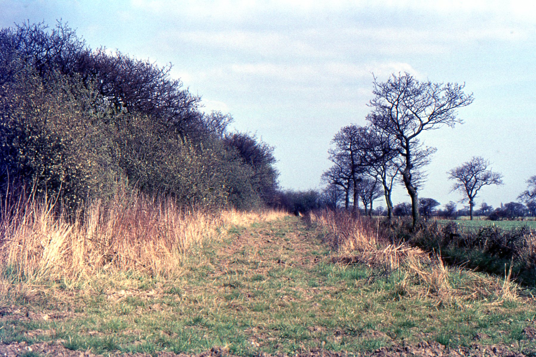
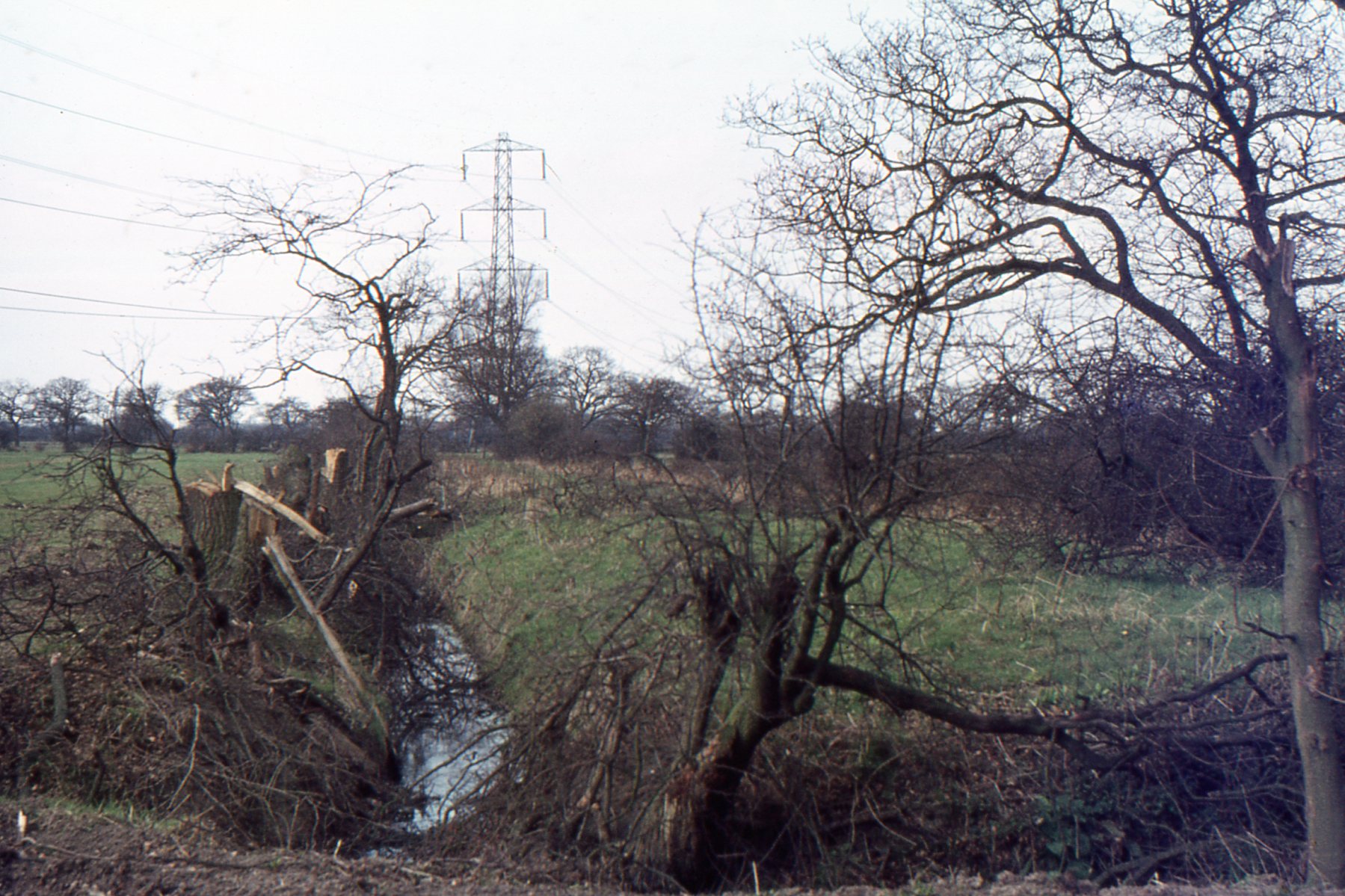
- An Inventory of Roads and Lane in Fishlake Past and Present.
- The Bylaw Books and Bylawmen of Fishlake.
- A List of Fishlake Field Names from Old Maps and Documentary Sources.
- The Sale Of Church Farm, Fishlake 1904.
- Quaker Burial Grounds in Fishlake.
- Downings Yard
- Church_Street_Cottages.pdf
- Church_Street_Cottages_2.pdf
- River Don Crossings : Jubilee Bridge Fishlake
- Did Fishlake once possess a forest?
- Thorninghirst: an ancient settlement.
- Ale Houses and Pubs in Bygone Fishlake.
- The Beginnings of Modern Policing in Fishlake
- Support for the Poor of Fishlake through the Ages.
- Who lived in Fishlake 700 years ago: The Taxation Records of 1297, 1342 and 1379.
- Old Fishlake Wills
- The Church Courts: Some Fishlake Cases.
- Churchwarden Accounts for Fishlake.
- The Home Front Kitchen.
- Six early images of old Fishlake village.
- Roberts Family postcards.
- Fishlake Childhood Memories.
- Church Plate belonging to St Cuthbert’s Church, Fishlake
- CHURCH BELLS AT ST CUTHBERT’S, FISHLAKE.
- Breaking News: Three Fishlake Men Refuse a Knighthood.
- Memories of Flood, Feast and Farm.
- George Ornsby 1859 Lecture about Fishlake Church
- Corn Mills and Millers in Fishlake
- Two Chantry Chapels at St Cuthbert's Fishlake
- The Glebe Terrier’s of Fishlake Church.
- Dovecotes in Fishlake.
- Fishlake’s Past Finding’s: What the newspapers were reporting about the village two centuries ago.
- Medieval Latin Wills of Fishlake Residents.
- A list of possessions at St Cuthbert’s Church Fishlake in 1552.
- The Strange Case of Rev Joseph Arrowsmith BA Vicar of Fishlake.
- PROBATE INVENTORIES. Some Fishlake examples.
- Morality, Dissent and Church Discipline in Fishlake, the evidence from Visitation Records.
- CUTHBERT’S HAVEN. Fishlake and the St Cuthbert connection.
- The Boating Dike. One of two anomalous man made features, formally part of Fishlake’s ancient landscape.
- A Story of a Church Clock: St Cuthbert’s Fishlake
- An important source of original documents relating to the history of Fishlake and Fishlake families.
- Fishlake Timeline
- Images
- Virtual Museum
- Oral History
- Fishlake Links
- Requests for help or information
- Contact Us
- Search
Fishlake History Society
Recording historical information before it disappears
- Historical Research
- Crime in Fishlake
- Fishlake Hall
- Whats in a name
- Rev J Leeson
- Fishlake's Physical History
- An Old Sketch Map of Fishlake
- The Township of Fishlake
- Published Histories of Fishlake
- Rev Eliezer Flecker
- Canon G Ornsby
- The Fishlake Pinder
- Fishlake Constable Accounts
- Stone relics to be found in Fishlake Vicarage Garden
- A Catalogue of Fishlake Historical records formally kept at Fishlake Church
- Fishlake Hearth Tax 1672
- Who tried to settle in Fishlake many years ago.
- What the travel writer found in Fishlake 120 years ago.
- Archdeacon Hopkins Badnall, Vicar of Fishlake 1886-1888. A two year ministration.
- Fishlake Endowed School Play.
- L'Isle Family and The Fishlake Connection.
- A Short History of Flooding in Fishlake.
- The First Photographers who captured pictorial images of Fishlake
- Early History of Fishlake Ferry
- Primitive Methodism in Fishlake and Two Preachers
- The Township Boundary of Fishlake
- The Phenomena of Detached Enclaves of Townships. The case of Fishlake and Sykehouse
- A catalogue of Incumbents at St Cuthbert’s, Fishlake
- An Inventory of Roads and Lane in Fishlake Past and Present.
- The Bylaw Books and Bylawmen of Fishlake.
- A List of Fishlake Field Names from Old Maps and Documentary Sources.
- The Sale Of Church Farm, Fishlake 1904.
- Quaker Burial Grounds in Fishlake.
- Downings Yard
- Church_Street_Cottages.pdf
- Church_Street_Cottages_2.pdf
- River Don Crossings : Jubilee Bridge Fishlake
- Did Fishlake once possess a forest?
- Thorninghirst: an ancient settlement.
- Ale Houses and Pubs in Bygone Fishlake.
- The Beginnings of Modern Policing in Fishlake
- Support for the Poor of Fishlake through the Ages.
- Who lived in Fishlake 700 years ago: The Taxation Records of 1297, 1342 and 1379.
- Old Fishlake Wills
- The Church Courts: Some Fishlake Cases.
- Churchwarden Accounts for Fishlake.
- The Home Front Kitchen.
- Six early images of old Fishlake village.
- Roberts Family postcards.
- Fishlake Childhood Memories.
- Church Plate belonging to St Cuthbert’s Church, Fishlake
- CHURCH BELLS AT ST CUTHBERT’S, FISHLAKE.
- Breaking News: Three Fishlake Men Refuse a Knighthood.
- Memories of Flood, Feast and Farm.
- George Ornsby 1859 Lecture about Fishlake Church
- Corn Mills and Millers in Fishlake
- Two Chantry Chapels at St Cuthbert's Fishlake
- The Glebe Terrier’s of Fishlake Church.
- Dovecotes in Fishlake.
- Fishlake’s Past Finding’s: What the newspapers were reporting about the village two centuries ago.
- Medieval Latin Wills of Fishlake Residents.
- A list of possessions at St Cuthbert’s Church Fishlake in 1552.
- The Strange Case of Rev Joseph Arrowsmith BA Vicar of Fishlake.
- PROBATE INVENTORIES. Some Fishlake examples.
- Morality, Dissent and Church Discipline in Fishlake, the evidence from Visitation Records.
- CUTHBERT’S HAVEN. Fishlake and the St Cuthbert connection.
- The Boating Dike. One of two anomalous man made features, formally part of Fishlake’s ancient landscape.
- A Story of a Church Clock: St Cuthbert’s Fishlake
- An important source of original documents relating to the history of Fishlake and Fishlake families.
- Fishlake Timeline
- Images
- Virtual Museum
- Oral History
- Fishlake Links
- Requests for help or information
- Contact Us
- Search
An Inventory of Roads and Lane in Fishlake Past and Present.
© 2026 Fishlake History Society